10:00 AM
10:10 AM

10:20 AM
3-Scenic Routing
by Luca Osten
Routing has become an important part of everyday life, whether it is finding the fastest way to work, avoiding traffic jams or road blocks, or finding the most efficient route for an electric car, avoid inclines to save on battery. We at calimoto believe, that future routing will go beyond just being efficient on distance, time and fuel. Another important aspect will be scenic routing, providing the user a flexible tool to plan nice joy rides on the weekend or the next road trip through Europe. Download Presentation: 3-SenicRouting-Luca Osten
10:40 AM
4-Demand modelling based on geostatic data calibrated using mobile network data
Information on how people move within urban areas enables a wide range of application. Shared mobility companies can use this information to optimize their business areas, public transportation companies can enhance their timetables and routes. Recently, mobile network providers have started distributing their data as origin-destination matrices as a basis for such use-cases. As part of our research, we have developed a demand model trained on aggregated mobile network data to address areas not covered by the provider’s data. A model is presented that uses correlations between movements and geostatical data such as population or land usage data. Multiple machine learning approaches were trained and tested, including methods like LASSO, Kernel-Ridge, Gardient Booosting and ANNs. The final model enables predictions for any (urban) area in Europe. Download Presentation: Download Presentation:
4-Demand modelling based on geostatic data calibrated using mobile network data-JesseHinrichsen
Download Presentation:
4-Demand modelling based on geostatic data calibrated using mobile network data-JesseHinrichsen11:00 AM
5-Smart Manufacturing and industrial RTLS
Nowadays location-based services are ubiquitously been used, for navigation, planning and control of all the different means of transportation out there, even autonomous once. This is also true for the industry domain, due to the fact that today’s production is globally distributed and there is a raising demand for flexibility.Large corporates are optimizing their supply chain – from just in time to just in sequence but fail to execute this pattern for intralogistic processes. This talk will give an overview approaches to provide industrial realtime location services and will highlight an approach to overcome the existing shortcomings. Download Presentations: 5-IndustrialRTLS-MatthiasJöst
11:20 AM
20 Minute Break
11:40 AM
6-Design Patterns of GeoData Driven Apps
by Shoaib Burq
Modern geospatial applications are becoming more and more complex. Whether it be an application for self driving cars or prediction engine for energy forecasting the number of moving pieces are increasing. Applications are dealing with real-time data, often with errors and/or missing data. In addition to this skills specialization means teams working on these applications have to collaborate and communicate across different aspects of the software in a meaningful way. This can range from machine learning and data science workflows to delivering meaningful insights to end users. In this talk we will describe design patterns of geo data pipelines in the age of big data & machine learning. We will provide tips on the open source options available to develop such architectures. Where possible we will identify gaps in the market. Download Presentations: 6-Geodata-drive-apps-ShoaibBurq
12:00 PM
7-Indoor Wayfinding with the new Generation of Google Access Points
Wi-Fi RTT allows the system and apps to “measure the distance to nearby RTT-capable Wi-Fi access points” with high precision (around 10 cm in Line-of-Sight). This feature was introduced in IEEE 802.11mc standard, and not so long ago, at I/O’18 Google announced that Android 9 Pie (API level 28) introduces support for indoor positioning by leveraging 802.11mc protocol. Navigine has demonstrated how it can help to get achieve submeter accuracy on Android devices. To demonstrate the opportunities of Wi-Fi RTT Navigine created testbed with 4 Google Wi-Fi access points which provide RTT measurements and Android Google Pixel 3a smartphone supporting Wi-Fi RTT. Testing was performed in restricted area of Navigine office with 9x11m size. The positioning engine is a particle filter combining Pedestrian Dead Reckoning (PDR), based on inertial sensors readings, and Wi-Fi RTT readings for correction. Download Presentation: 7-Indoor Wayfinding with the new Generation of Google Access Points-RTT-Navigine
12:20 PM
8-Improving mobility for events
Organising events is already hard enough. From finding the perfect location to booking the best acts, there is so much that requires an event manager's attention. With triply, we enable events to generate transport solutions at the click of a button. Right now we are automatically calculating potential stops, grouping them to routes and brokering needed rides to local bus companies all over Austria. In this short presentation, I will give a short introduction into problems faced and insights gained on our path from manually organising rural event buses to automatically providing mobility solutions for event locations. Last but not least, I will give a quick outlook on what's next to come for our rapidly growing startup. Download Presentation: 8-Improving mobility for events-ChrisStelzmüller-triply
https://www.triply.fun
8-Improving mobility for events-ChrisStelzmüller-triply
https://www.triply.fun12:40 PM

01:00 PM
01:40 PM
02:00 PM
02:20 PM
12-Mapping driver cognitive load
Using a mix of static map data, weather and real-time traffic, we compute scores for complexity and risk of specific road situations. These scores are then used to adapt the behaviour of Chris, our digital voice assistant for drivers. Presentation Download: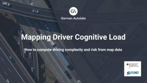 12-Mapping driver cognitive load-Markus Gräser-Germanautolabs
02:40 PM
13-Automated and connected driving in Berlin-Reinickendorf
by Oliver Strop , Luca Ricci ,
https://www.testfeld-berlin.de/ Flyer: https://www.testfeld-berlin.de/pdfs/SafariDTS-Falzflyer-Wickelfalz-v14-EN.pdf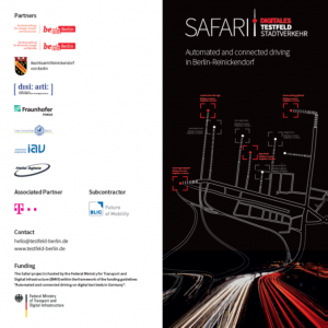 Extracts from Flyer:
Objective
In the research project SAFARI, the Land of Berlin together with partners examines the exchange and updating of digital HD maps as a prerequisite for automated and connected driving. In the district Reinickendorf, using highly accurate HD maps, modern infrastructure and a high level of connectivity, three fundamental technologies are being developed and tested: sensory environmental awareness and localization, communicating road infrastructure, and self-updating HD maps.
Digital traffic management
Highly accurate HD maps are a prerequisite for digitalization of mobility. For the Senate administration for environment, traffic and climate protection these are already an indispensable working basis. Likewise, for years the Berlin universities, research institutions, and companies are researching the fundamentals for automated and connected driving. An important basis for the view and circumspection of the vehicles in traffic is the updating of the maps in real-time. These are not the only overlaps between a modern city and highly automated vehicles. The connectivity between infrastructure and the connected vehicles offers many opportunities for an efficient and safe regulation of traffic.
What do the vehicles see?
SAFARI uses not only research vehicles but also vehicles retro-fitted with low cost sensor technology and tests the use of smartphones for cost-effective data collection. In the research vehicles, special LIDAR-sensors are integrated, which use laser beams to accurately scan the road and its surroundings. The huge amounts of data acquired thereby can be processed and sent to the cloud without delay thanks to modern low-latency communication technology. As privacy is a major concern, the data is anonymized such that no individual movement profiles can be derived.
Updating maps
On the basis of the data collected, changes in the road space and driving trajectories of the vehicles have to be recorded, processed and stored in dynamic maps in order to be able to play them back to other vehicles. This constant feedback enables a continuous self-updating of the map content. Information
such as free parking slots at the side of the road or the checking of a recently established construction site is generated nearly incidentally.
Recognize traffic lights/
understand the surroundings Based on highly accurate HD maps, the vehicles are able to localize themselves on the road down to centimeters. Classical GNSS-based systems alone have a positioning error of over 10 meters after driving under bridges or urban canyons. Thereby the car would stop on the crossing and not at the traffic light. SAFARI brings together map information – “there should be a
traffic light here” – with connected road infrastructure – “traffic light will switch to green in 7s” – and vehicle sensors and thereby enables a safe and comfortable automated drive totally without hectic braking maneuvers.
Download Presentation:
Extracts from Flyer:
Objective
In the research project SAFARI, the Land of Berlin together with partners examines the exchange and updating of digital HD maps as a prerequisite for automated and connected driving. In the district Reinickendorf, using highly accurate HD maps, modern infrastructure and a high level of connectivity, three fundamental technologies are being developed and tested: sensory environmental awareness and localization, communicating road infrastructure, and self-updating HD maps.
Digital traffic management
Highly accurate HD maps are a prerequisite for digitalization of mobility. For the Senate administration for environment, traffic and climate protection these are already an indispensable working basis. Likewise, for years the Berlin universities, research institutions, and companies are researching the fundamentals for automated and connected driving. An important basis for the view and circumspection of the vehicles in traffic is the updating of the maps in real-time. These are not the only overlaps between a modern city and highly automated vehicles. The connectivity between infrastructure and the connected vehicles offers many opportunities for an efficient and safe regulation of traffic.
What do the vehicles see?
SAFARI uses not only research vehicles but also vehicles retro-fitted with low cost sensor technology and tests the use of smartphones for cost-effective data collection. In the research vehicles, special LIDAR-sensors are integrated, which use laser beams to accurately scan the road and its surroundings. The huge amounts of data acquired thereby can be processed and sent to the cloud without delay thanks to modern low-latency communication technology. As privacy is a major concern, the data is anonymized such that no individual movement profiles can be derived.
Updating maps
On the basis of the data collected, changes in the road space and driving trajectories of the vehicles have to be recorded, processed and stored in dynamic maps in order to be able to play them back to other vehicles. This constant feedback enables a continuous self-updating of the map content. Information
such as free parking slots at the side of the road or the checking of a recently established construction site is generated nearly incidentally.
Recognize traffic lights/
understand the surroundings Based on highly accurate HD maps, the vehicles are able to localize themselves on the road down to centimeters. Classical GNSS-based systems alone have a positioning error of over 10 meters after driving under bridges or urban canyons. Thereby the car would stop on the crossing and not at the traffic light. SAFARI brings together map information – “there should be a
traffic light here” – with connected road infrastructure – “traffic light will switch to green in 7s” – and vehicle sensors and thereby enables a safe and comfortable automated drive totally without hectic braking maneuvers.
Download Presentation:
 13-SAFARI_SenatsverwaltungBerlin
03:00 PM
03:20 PM
14-Crash Analysis System (CAS) – a crash data analytics and visualisation platform
by Peter Rose , William Jones ,
Orbica and partner Catalyst developed a user-friendly web application to live stream New Zealand Transport Agency’s 1.5 million crash record database so that transport planners and engineers (with no prior SQL knowledge) could perform complex stacked spatial and aspatial queries with ease. The following components and corresponding APIs were built: • A React, Leaflet and WebGL based front-end • A PostgreSQL/PostGIS and SQL Server spatial-based geospatial database • PHP, SilverStripe, web socket-based layer for data streaming Orbica mixed and tweaked existing Leaflet plugins to create comprehensive modular components for the GIS aspects of the CAS solution. Main features included: • A fully “edit geometry” standardised plugin including the following: o Leaflet.FreeDraw o Leaflet.draw o Specific business editing functionalities This works in conjunction with map data visualisation and schematic/mapping data visualisation developed using PIXI/WebGl. The road safety community uses CAS to output complex collision diagrams and reports to help them advocate for road safety improvements. Download Presentation: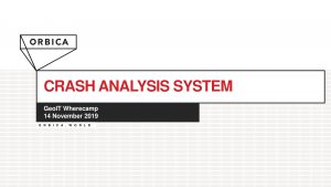 14-Crash-Analysis-WilliamJones-Orbica
03:40 PM
15-UAV RTK-GNSS: finally a solution for forest mapping?
Acquiring reliable fixed GNSS solutions under a dense forest canopy is typically unattainable even in more sparse forest stands. Required is not only the accurate global positioning of complete forest stands for UAV- and satellite-based time series analysis, however also for determining or establishing permanent measurements of ground points for field crews. Traditional aerial photogrammetric methods involving Ground Control Points (GCPs) are a challenge in forested areas due to high costs when measured with a total station, float GNSS solutions (sub 2 meter accuracies), moving tree crowns during windy conditions as well as GCP aerial visibility. Recent developments in off-the-shelf RTK-GNSS supported UAVs has provided the potential to map forest stands with fixed GNSS solutions in a rapid manner without or a minimal use of GCPs. This study was carried out at the Britz research station for intensive forest monitoring implementing a configuration of 51 GCPs for validation measured with a total station. A method was developed to acquire ground measurements of a forest stand with aerially visible targets resulting with sub-decimeter accuracies before post processing. Download Presentation: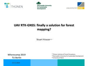 15-UAV RTK-GNSS finally a solution for forest mapping-StuartKrause
04:00 PM
04:20 PM
17-Assisted Intelligence – Mapping with support of new technologies
Deep learning methods for feature extraction using computer vision are giving concrete results. This talk provides an overview of how feature detection from satellite imagery can provide a seamless experience for mappers in OpenStreetMap. Over the last year the Humanitarian OpenStreetMap Team facilitated an initiative to test using data derived using machine learning models to improve coordination of groups of mappers, quality of edits and overall experience when mapping in OpenStreetMap. During the talk the concrete results are shown and you will obtain a good idea about the state of machine learning data and tools around OpenStreetMap. Download Presentation: 17-AssistedIntelligence-FelixDelattre
04:40 PM
05:00 PM
IGG - Leseraum - Level 5 in Main Building
06:00 PM
Café Hardenberg,
Hardenbergstraße 10, 10623 Berlin